Quick access
Discovering the Arctic
History of Arctic
Discovery of the Arctic began in 330 BC with Pytheas, a Greek explorer from Marseille, who left to sail northwards as far as the Shetland Islands or Iceland.
Later, around 982
The Viking Erik the Red left Scandinavia for Iceland then, expelled from the island, he founded a colony in Greenland (“the green country”) giving it that name in the hope of attracting possible colonial settlers.
1594-1597
The Dutchman Willem Barents discovered Spitsbergen (already known to Nordic navigators). However, his ship, trapped in the ice, was damaged and the crew were forced to overwinter in dreadful conditions, north of Novaya Zemlya (76°N), the first time for any Europeans.
1616
Searching for the Northwest passage, William Baffin and Robert Bylot voyaged north along the west coast of Greenland as far as 77°45’N. They discovered the Lancaster, Smith and Jones Sounds. Only 2 centuries later the Northwest Passage leading to the Arctic Ocean was navigated by an expedition. This route was later found to lead to the Pacific Ocean, through the Bering Strait.
1725-1741
Danish explorer Vitus Bering, sent by Tsar Peter the Great, discovered the strait between Siberia and America, which now bears his name, the Aleutian Islands and the south coast of Alaska, of which he took possession in the name of the Czar.
In 1818
British naval officer John Ross along with Edward Parry entered Melville Bay and became the first Europeans to encounter “Eskimos” whose particular characteristic was to “move around at great speed on sleds pulled by dogs”. They looked in vain for the Northwest Passage before turning back in the Lancaster Sound. Parry made a second expedition (1819-1820), reaching meridian 113°W.

1878-1879
After a first failed attempt to reach the North Pole in 1872, Swedish explorer Adolf Erik Nordenskiöld made a huge effort to find the Northeast Passage, sailing along the Siberian coastline. In September 1878 Nordenskiöld became frozen in by the ice, then decided to overwinter at in Kolyuchin Bay, 200 km west of the Bering Strait. He finally broke free from the ice in 18 July 1879 (having been blocked for 294 days); 2 days later, he successfully reached the Strait.
1893-1896
The Norwegian Fridtjof Nansen drifted with the Fram across the Arctic Ocean. In so doing he brought proof of the existence of the transpolar marine current which drives the drifting of the sea-ice.
1903-1906
The Northwest Passage was not gained by sea until 1906 when the Norwegian explorer Roald Amundsen finished a 3-year journey with the Gjøa. During this voyage the explorer learned the Inuit techniques that later enabled him to reach the South Pole in 1911.
1909
The American Robert Peary announced that he had arrived at the geographical pole on 6 April but without making any observation of longitude, or offering the smallest proof. His old friend, Dr Frederick Cook did little better, although claiming that he had “reached the pole, 21 April 1908, and discovered land in the Far North”. It appears in reality that Peary got very close to the North Pole (a few miles) but had not reached the actual point.
1937-1938
The Russian Ivan Papanin and several fellow explorers left Franz-Josef Land by plane, landing at 89°43’N. They established the first drifting base on 21 May, before drifting for 9 months until they reached the Greenland Sea.
1948-1953
Expeditions by French explorer Paul-Émile Victor to Greenland.
En 1958
The American nuclear submarine Nautilus crossed the Arctic Ocean and passed under the North Pole on 3 August. Then on 17 March 1961, Skate, another American nuclear submarine, surfaced at 90°N.
1968-1969
The British plar explorer Wally Herbert crossed from Point Barrow (Alaska, 21 February 1968) to Spitsbergen (29 May 1969) by way of the Pole by sled traîneau. As Robert Peary had not truly got to the North Pole in 1909, Herbert was the first ever to have reached by walking “overland”.
Geography and geology
Simon ESCALLES
A region in the north of the Earth, in and around the Arctic Circle, parallel to latitude 66°36′. This is the limit of the “midnight sun”.
The name of the Arctic comes from the Great Bear constellation, located to the north (arctos = bear (Greek)). This region takes in the Arctic Ocean, a large part of which is permanent ice (sea-ice) and the north of the continents which surround it: including the Scandinavian Peninsula, the north of Russia and Siberia, of Alaska, Canada, Greenland and Spitsbergen. The geopolitical situation of the Arctic is very different from that of the Antarctic.
To read more…
If the limits of the Arctic Ocean (13 000 000 km² and more than 4000 m depth) are perfectly defined, how can the border of the Arctic regions on land be fixed? By the Arctic Circle, the treeline or by the limit of the land that is constantly frozen at depth, the permafrost? The most commonly recognized answer is the line within which the air temperature never exceeds 10°C during the warmest months (July). This isotherm, called the Köppen line, coincides quite well with the transition from boreal forest (taiga) to tundra. According to this, the Arctic would stretch over an area of about 24 million km², including 17 million of ocean, a little more than 3 million of continent and nearly 4 million of scattered islands, from the Aleutians to Labrador, with its maximum diameter exceeding 7000 km.
North Magnetic Pole
The North Magnetic Pole is defined as the point on the Earth’s surface where the direction of the magnetic field runs exactly vertically downwards. At the North Magnetic Pole, the magnetic dip (the angle between the direction of the field and the horizontal) is 90° and the magnetic declination or variation (the angle between the direction of the field and the geographic North Pole) is not definite. In the same way there is a magnetic South Pole where the magnetic field is exactly vertical upwards.
Care should be taken not to confuse the magnetic poles (North and South) and geomagnetic poles. The latter are defined as the intersection points on the Earth’s surface where the axis of the magnetic dipole passing through the Earth’s centre gives the best first-order approximation of the global magnetic field. Inevitably therefore the geomagnetic North and South poles are antipodal, in contrast with the magnetic poles. The difference between the two types of pole stems from the fact that the Earth’s magnetic field is not exactly dipolar at the scale of the whole globe. This is why, even though all the magnetic meridians converge at the North Magnetic Pole, they do not arrive radially: compasses lead to the North Magnetic Pole without ever pointing in that direction!
James Ross was the first to fix an exact location for the North Magnetic Pole, in 1831. Amundsen followed in 1904. At that time the pole was situated at the Boothia Peninsula in the Far North of Canada. The pole moves around owing to the geomagnetic secular variation, itself induced by convection movements of liquid iron in the Earth’s core. For this reason expeditions were run regularly in the 20th Century to update the position of the pole on the magnetic maps.
The latest in situ determination of the position of the pole was performed by a Franco-Canadian team (L.R.Newitt, A.Chulliat and J.-J.Orgeval, Poly- Arctic project) in April 2007, using several measurements taken in a radius of about 100 km around the pole. The position obtained was 83.95°N, 121.02°W, effectively around 800 km to the north-west of Ellesmere Island. These field observations have been more and more difficult owing to increasing distances and global warming. For several years they have been complemented by satellite measurements.
The North Magnetic Pole drifted quite slowly (less than 10 km/year) towards Siberia from 1834 to 1980. From the mid 1980s, the speed of the drift has been increasing to reach the present-day 55 km/year (still towards Siberia). This speed appears to have stabilized since the beginning of the 2000s. If it continues at the same rate, the North Magnetic Pole will reach Siberia in around 2040.
This quite abrupt acceleration has yet to find a full explanation. It could be linked to an increase in the magnetic field flux in the polar area North of the Earth’s core. This increase could be caused by the expulsion of the lines of the magnetic field from the core, in a mechanism rather like the processes that induce sun spots.
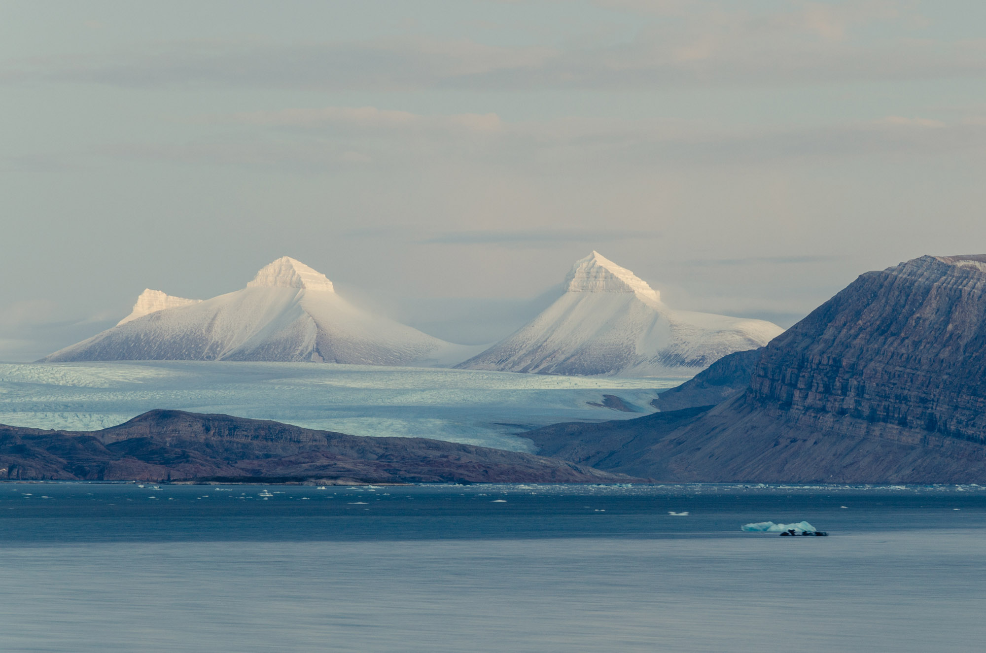
Topography and bathymetry
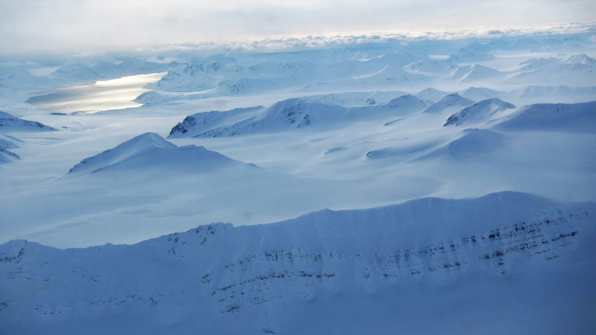
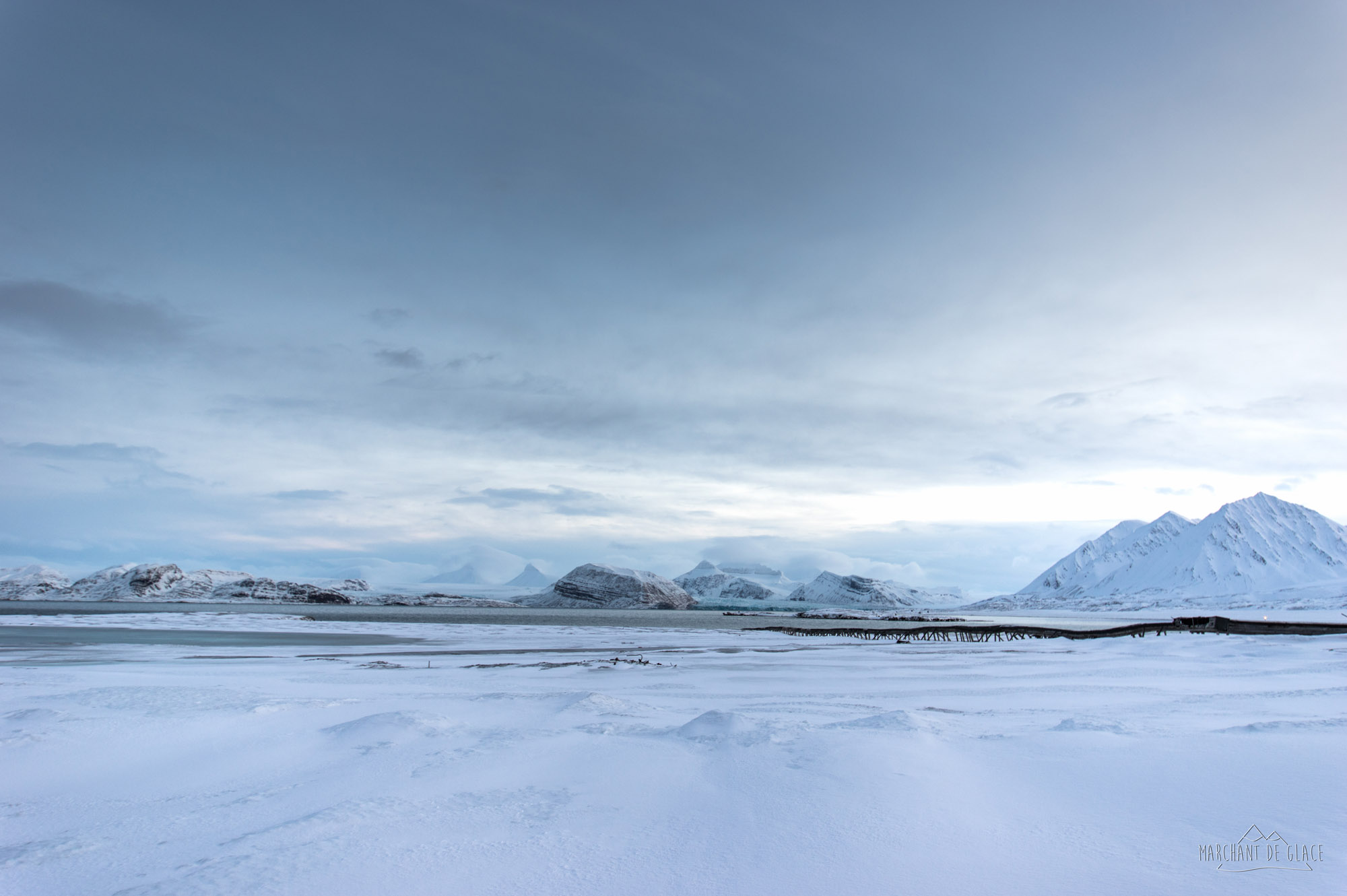
The landscapes in the Arctic are extremely diversified. They include sea-ice, strongly carved coastlines, coastal plains, hills and mountains reaching beyond 6000 metres above sea level (Mount McKinley at 6194 m, in Denali Park in Alaska). Rivers and lakes abound, also tundra, and the region supports the world’s most extensive forests (Russian Taiga).
The Tundra
The original Russian term tundra denotes the circumpolar plant community which takes over from the taiga (which supports trees) towards the north. This community grows on soil that is permanently frozen, at least at depth, the permafrost. From south to north, the first type encountered is shrubby tundra with shrub-scattered moorland consisting of a range of species of dwarf willow, open moorland then grasslands (herbaceous tundra), followed by zones where mosses and lichens are the only representatives of vegetation (some of them are eaten by reindeer). All these plants have their growth slowed down by the climatic conditions (freezing, wind, etc.), the alternation between a long winter night and a long summer day and the poverty of the soil. The soil infertility is due to lower bacterial activity: there is very little decomposition of the organic matter that accumulates and gives rise to peat. The short vegetative period is however sufficient to attract a host of migratory birds (eider, black geese (Branta), snow goose, etc.) and make it a zone of intense animal life and reproduction.
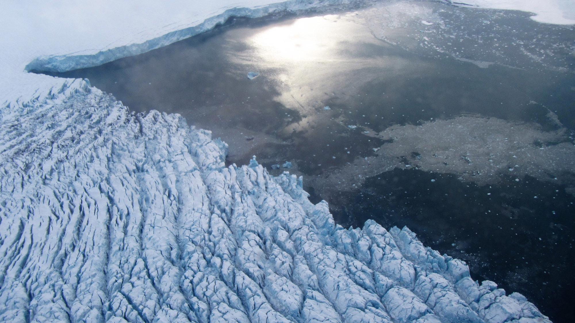
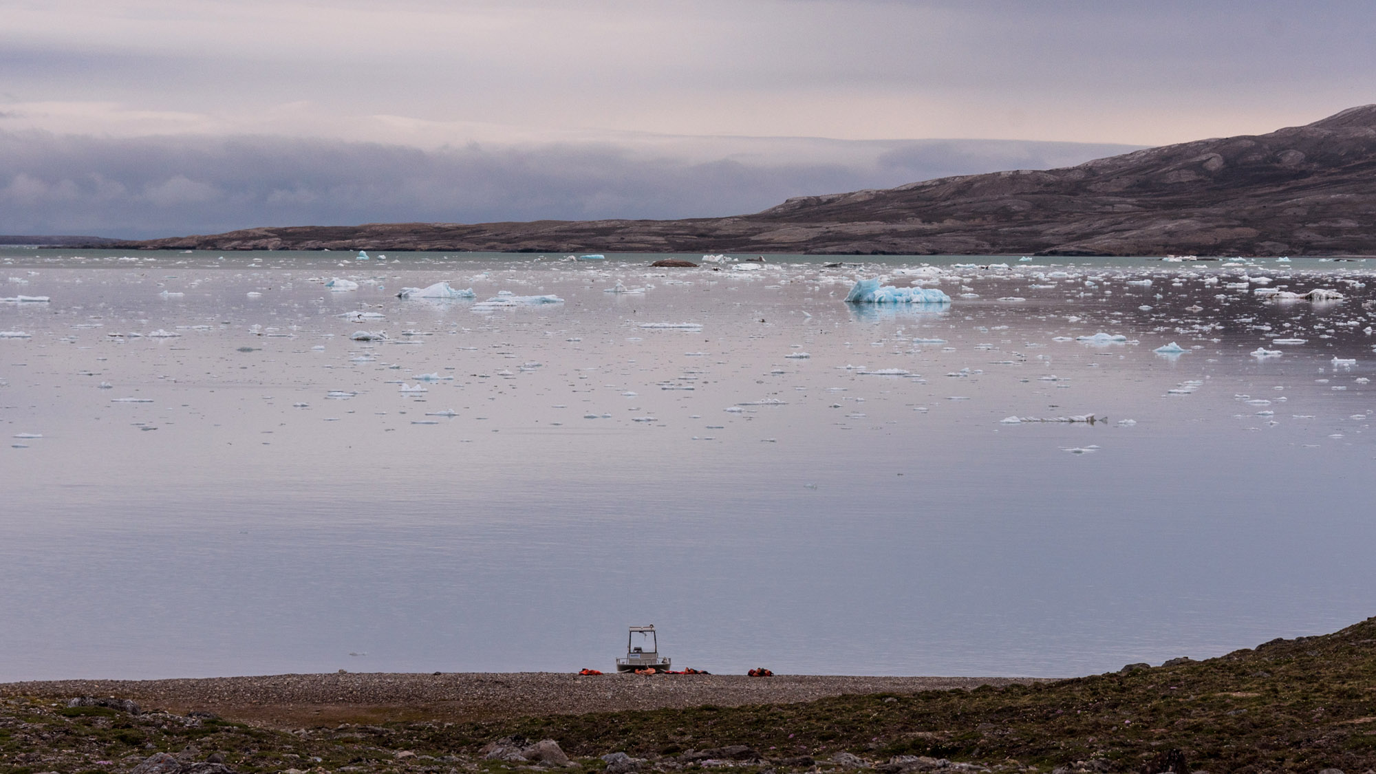
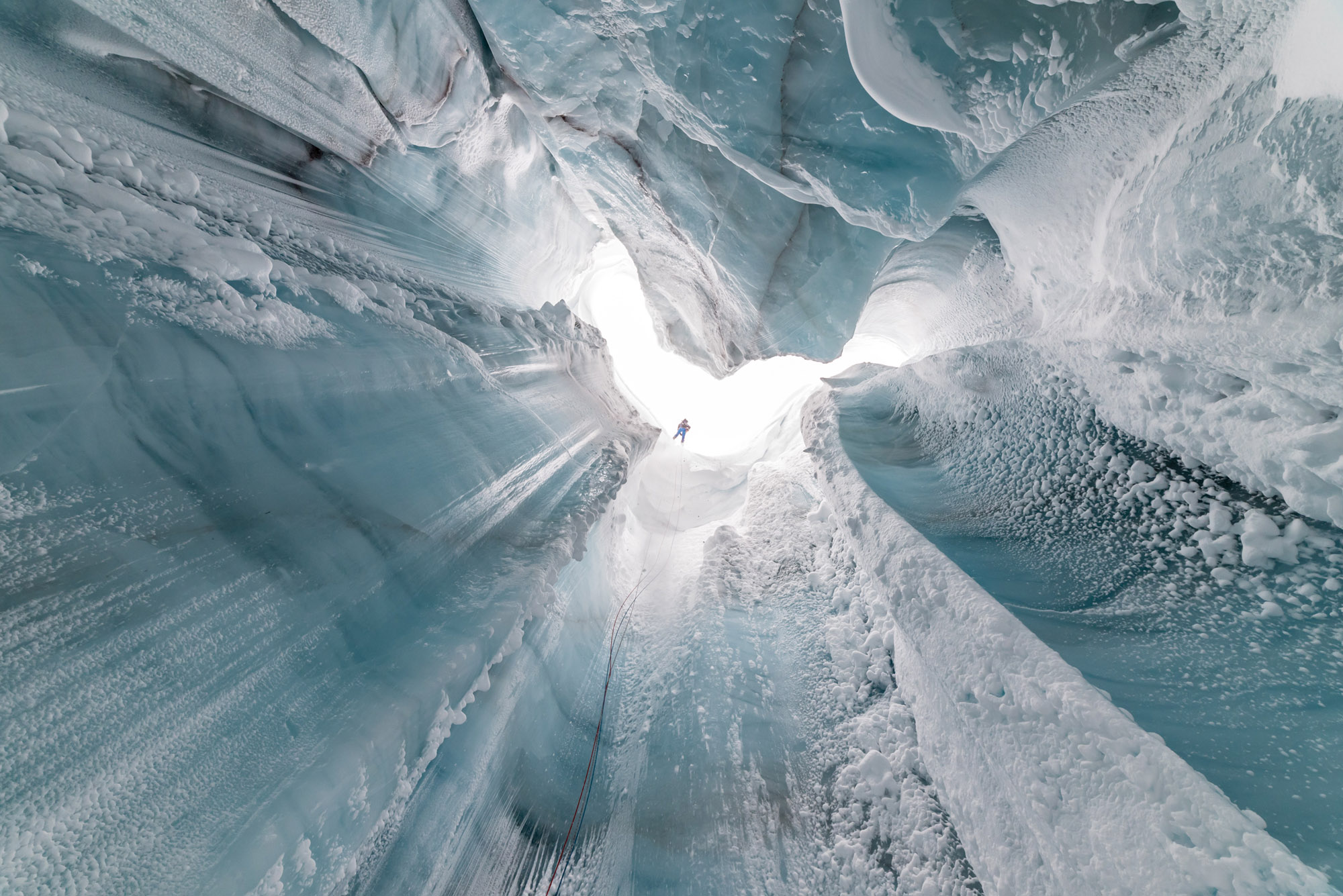
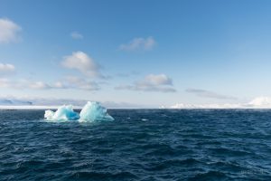
The Sea ice
This is a mass accumulation of floating ice, formed by freezing of sea water, also known as pack ice. Sea-ice consists of the year’s ice which forms at the beginning of winter (ice-jam) and thaws in spring (break-up) along with older polar ice. It is subjected to tidal movements and drifting driven by marine currents and winds.

Simon ESCALLE
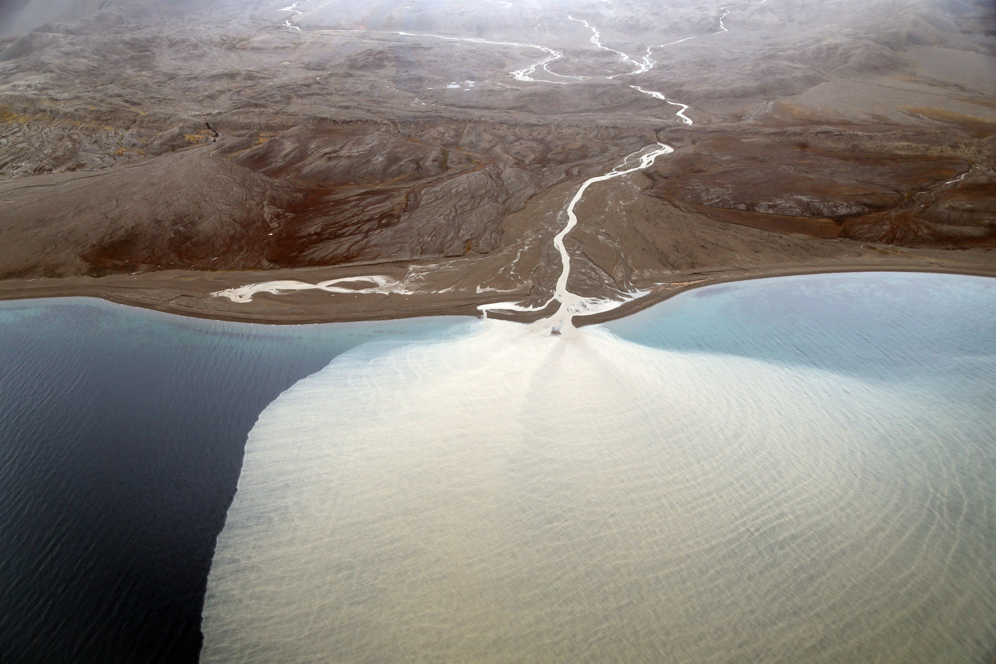
The Permafrost
The permafrost is a horizon of the subsurface which does not undergo thawing for at least 2 years running. It holds a record of the negative heat balance over a long period (103 years) with an accumulation of ice lenses, especially in the first 10 m of soil. Its upper horizon thaws each year: this is the active layer where cryoturbation occurs in the form of stones circles. At present the permafrost stretches at low altitude between 57°N on the eastern sides of the continent and 70°N on the western margins. Its thickness varies from 20 m in the South reaching 300 m in the zones not overlain by ice 10 000 years BP and more than 600 m in the non-iced hyper-continental zones of the Quaternary (Siberia). The record depth is held by the Verkhoyansk Range in eastern Siberia where depth exceeds 1000 m. The permafrost can be continuous to the North (> 80% of the surface area), discontinuous (between 30 and 80%) and sporadic to the South (Iceland, Lapland, Quebec).
In the warmest times of the Holocene, 8000 years ago, the permafrost was restricted to the area included within the Arctic Circle. Since then it has again advanced towards the South. Following the fall in summer solar radiation during the Holocene, the current southward spread of the permafrost reaches about 1/3 of the extent it had at the Last Glacial Maximum. The Russian authors consider the Arctic permafrost to be ancient (7-5 million years). Its thermal mass gave it deep resistance, both to the warming of the Lower Pliocene (4.2 million years BP, when there were palm trees in the Netherlands!) and to the warmest interglacial periods of the recent Quaternary, the Eemian (132-110 000 years BP, with Portuguese fish reaching Denmark !). A large amount of ice formed in the top layer of permafrost during warm humid episodes, for example 8000 years BP. The most recent permafrost is less rich in ice. When this accumulated ice melts the ground collapses: thermokarst or thaw lakes then form. This occurred already in the early Holocene and before the Little Ice Age.
When the permafrost cools down again, it can incorporate peat, blocking the annual production of methane, particularly in the continental subarctic climate zone. Deep down, around 200 m, large quantities of gas hydrates (methane) can build up; these accumulations do not form at shallower depths.
Rodolphe MERCERON
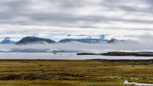
Arctic Ocean
The Arctic Ocean covers an area of about 13 million km², making it the World’s smallest ocean. It reaches depths of more than 4000 m. This ocean stretches over all the seas situated between the North Pole and the northern parts of Europe, Asia and America. It is connected with the north of the Atlantic Ocean, receiving an input of large bodies of water through the Barents Sea and the Fram Strait. It also has some contact with the Pacific Ocean, through the Bering Strait, but this passage is narrower.
Simon ESCALLES
Arctic Ocean circulation
The circulation of waters in the Arctic Ocean is a key player in World Ocean circulation and global climate regulation, owing particularly to the heat exchanges it effects with the atmosphere. When relatively warm, strongly saline water bodies moving from the Atlantic (by the Gulf Stream for example) arrive in the cold Arctic Ocean, where the resulting temperature decrease induces their density to rise. That causes them to plunge further down into deeper layers, forming deep-water masses. This process is “thermohaline circulation” (from Greek thermos, warm, and halos, salt). It moves slowly but over vast surface areas. Every winter therefore, several million km³ of water is driven towards the deeper zones, slowly moving water southwards, along the deep along the floor of the Atlantic Ocean. The slow mixing process in the oceans has been represented by oceanographers by a global-scale conveyor belt. Many other currents (surface, deep and mid-depth) circulate in the Arctic Ocean in a complex configuration. They include the Nansen currents, operating at the surface, which cause the sea-ice to drift.
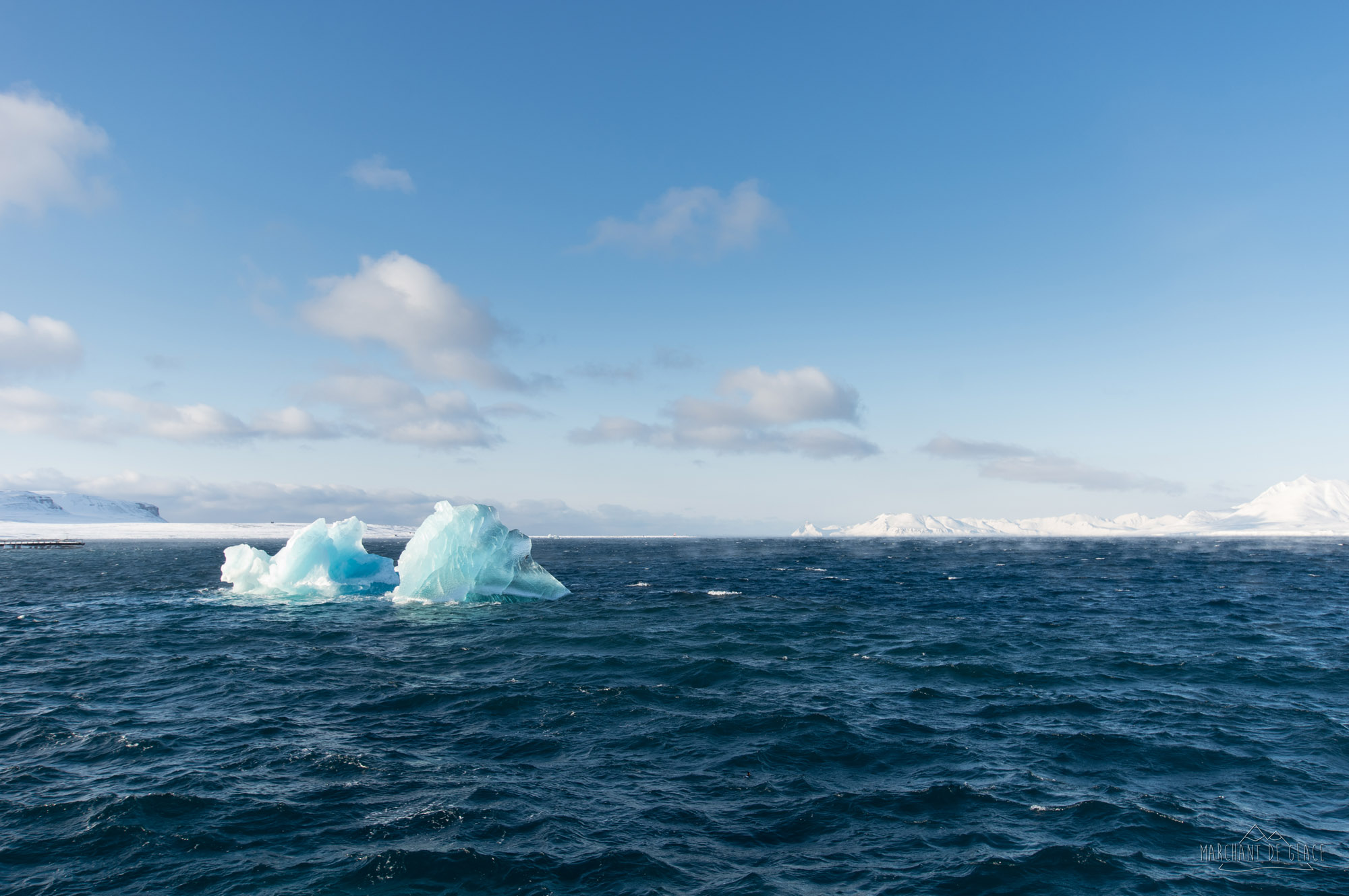
Sea-ice
The Arctic Ocean is largely covered by a thick layer of sea-ice whose extent varies with the seasons. It is mobile, continually being fragmented and remodelled by the winds and currents. In summer, when the sea hardly freezes, the sea-ice breaks up into a multitude of floating islands of ice or floes. With the changing seasons, the covering of Boreal ice shifts between about 8 and 15 million km². In its central area the sea-ice can attain a thickness of 4 m.
Climate
It is difficult to characterize one specific Arctic climate. Indeed, the Arctic encompasses different types of region where the climate can be rather different from one place to another. Several factors can produce variations in climate, including latitude (more or less northwards), distance from coasts (it is generally colder inland), whether or not marine currents are present (like the Gulf Stream which warms the coasts of Scandinavia), altitude, or relief. Several climates can exist within the same region, Alaska for instance. Moreover, in the polar regions, the top-of atmosphere radiative balance is negative, meaning that more heat is lost than gained. This effect is linked to loss of energy which can be explained by: The energy of the solar radiation is lost by a maximum amount in reaching the poles because there it crosses the atmosphere always at an oblique angle; therefore the nearer the poles, the longer its path. The quantity of energy received by a given surface area in the polar regions is therefore lower than that for the same area in the equatorial regions. This effect is moreover accentuated by the Earth’s curvature and axial tilt.
The snow and ice also play a role. Whereas on average the Earth’s surface and atmosphere sends back 30% of the solar energy, this reflection is accentuated by the whiteness of the snow, which reflects 80% of the incident light back towards space.
These variables influence the Arctic climate. A climate characterized by the disparity of its seasons, the Earth’s tilt in relation to the Sun expressed in most of the region by the existence of seasons of highly variable length: winter lasts about 9 months (involving 6 months of polar night for the regions furthest north), summer is only1/3 as long whereas spring and autumn are like transition periods no longer than a few weeks. At Resolute in Canada (74°N), the period without frost is restricted to 9 days per year on average! The Arctic climate may well be harsh, but it would be even more so if it did not enjoy the warmth carried in by the ocean and atmospheric currents from warmer regions. This makes the climate nonetheless “milder” than in the Antarctic.
Peoples of the Arctic
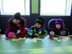
The human populations known as the “Arctic” peoples (including the Inuit, Sami and Évenks) have developed ways of life very well adapted to harsh living conditions (very cold climate, sparse vegetation, the polar night and so on).
The Saami people are indigenous to an area covering the north of Sweden, Norway, Finland and a small part of Russia. They Sami form one of the largest autochthonous groups in Europe. They do not constitute an ethnic group but a people speaking the same Finno-Ugric languages (10 of which have been identified).
To read more…
The Sami are more commonly known as Lapps, although members of the community prefer the name Sami or Saami, which they therefore use to refer to themselves. The term Lapp is considered pejorative (close to the High-German lapp, meaning stupid). They call their ancestral lands Sápmi (Lapland).
Although these peoples are spread over an immense surface area, and their populations reach only small numbers, their clothes, tools, techniques, social organization and cultural features show striking similarities, whether they are from Siberia, the far north of Europe or Arctic America. Nevertheless, these peoples do show way-of-life differences such as sedentarization/nomadization, hunting/animal husbandry, the species used depending on their location, their relations with the other peoples, etc.
Indigenous peoples of the Arctic
The Inuit (or Eskimos), present from north-east Siberia to Greenland, by way of Alaska and Canada.
The designation Inuit (adopted by ethnologists at the Washington International Conference) groups together several Arctic populations spread between 56°N and 76°N, from eastern Siberia as far as the east coast of Greenland, a territory that totals 15 000 km of coastline. From the linguistic point of view, the Inuit are classified into two groups:
- Those who speak Yupik (in Siberia, in the islands of the Bering Sea on the south-west coast of Alaska)
- And those speaking Inupiak (or Inuktitut, from the north of Alaska to the east of Greenland).
The Inuit are attached politically to 4 nations (Russia, USA, Canada and Greenland). Their numbers reach nearly 150 000. The largest group (more than 50 000) are found in Greenland, with the Kalaallit from the west coast and the Ammassalimiut from the east coast.
The term Eskimo, generally corresponding to the Inuk people of the Far North of Canada, Alaska and Greenland), comes from the crie language (of the Amerindian people of North America). It means “he who eats raw meat”. In Canada, the Inuit prefer the name they use themselves, Inuit, signifying “the people” in Inuktitut. The singular is Inuk and the dual Inuuk.
An Inuk, some Inuit
The Inuit are not related to the Amerindian peoples, who arrived some millennia before them. Nevertheless, the same political questions arise concerning the Inuit and the Amerindians.
The most important process of territorial claims in Canada’s history led in 1999 to the foundation of Nunavut, a new territory conceived as homeland for the greater part of the Inuit of Canada, with the name meaning “our Land”.
Moreover, in order to meet the claims of the Inuit of the Nunavik region, in the Quebec Arctic, the Quebec government set up the Kativik Regional Administration under the James Bay and North Quebec Agreement. In Canada, the Inuit are represented by the Inuk Tapiriit Kanatami.
The Sami (or Lapps) in the north of Scandinavia and the west of Russia.
There are between 60 000 and 100 000, spread over the Nordic ice sheet running from the Norwegian shores to the Kola Peninsula (Russia). More than half of them live in Norway, whereas about 20 000 are inhabitants of Sweden, 6000 are in Finland but hardly 2000 in northern Russia. Contrary to popular belief, only 10% of Sami practise reindeer husbandry and transhumance. Most of the population operate in other activities: agriculture, fishing, industry, the tertiary sector (in the north, but also in the large cities of the south). Reindeer domestication and husbandry never became widespread, in fact it entered relatively late into Sami history as they previously lived by hunting this animal. It was mainly from the 17th and 18th Centuries that the domesticated reindeer became the principal resource for Sami communities in the mountains and forests, at the same time as the animal became the epitome of Sami culture.
The Sami have the right to vote in Sweden, Norway and Finland (but not in Russia), in the democratically elected Sami Parliament, an especially designated authority with government powers.
The “Indigenous small-numbered peoples” of Russia, a term which encompasses a mosaic of ethnic groups that are more or less affiliated with each other (including the Evenks, Nenets, Chukchis, Aleuts) and whose populations are low (< 50 000 individuals).
This is the collective name the Russians give to the mosaic of autochthonous peoples (43 recorded in 2000 by the Russia Federation) spread across the Arctic and Subarctic of Eurasia, particularly in Siberia.
19 ethnic groups belong to the Arctic area – permanently or otherwise, as many of them are nomadic. Following a simple ethno-linguistic classification they can be separated into 3 broad families: Uralo-Siberian, Altaic and Dené-Caucasian.
From west to east: Sami – Nenets – Mansi – Selkups – Enets – Khanty – Ket – Nganasan – Dolgans – Evenks – Evens – Yukaghir – Chuvants- Chukchi – Kereks – Alyutors – Koryaks – Aleuts- Inuit
The broad Uralo-Siberian family, the most ancient of Siberia, occupies a large area in northern Russia. It subdivides into 5 families: Finno-Ugric, Samodeic, Yukaghir, Eskaleut (Eskimo-Aleut) and Luoravetian (or Chukotko-Kamchatkan).
- The Finno-Ugric family subdivides into 2 branches: Finns with the Sami and Ugric with the Khanty and the Mansi.
- The Samodeic family (formerly Samoyedic) consists of 4 ethnic groups: Enets, Nenets, Nganasans and, further south, Selkups.
- The Yukaghir family now includes only 2 ethnic groups: Yukaghirs and Chuvants.
- The Eskaleut family is established both in Asia and America, but its strongest expansion has been on the American continent, home of 2 peoples who are emblematic of the Arctic: the Yupik Eskimo (Inuit of Siberia and Alaska) and the Aleuts. The common Eskaleut ancestor is thought to have split into Inuit and Aleut around 3000/2000 BP.
- The Luoravetian family was long classified with a disparate “Palaeo-Asiatic” language group. The branch contains 4 ethnic groups inhabiting the polar zone (Alyutors, Koryaks, Kereks and Chukchi). The Kamchatkan group (Kamtchatadals and Itelmens) is not included in the polar zone for geographic and ethno-genetic considerations.
The broad Altaic family is represented in the Siberian Arctic by 2 families: the Turkic languages spoken by the Yakuts and the Dolgans, and the Tungusic spoken by the Evens and the Evenks. The Tungusic peoples entered Siberia early in the 1st Century AD. They reached the Arctic around 1000, practically at the same time as the Yakuts began their advance southwards. The Yakuts (or Sakhas) are not considered as a minority because the population was at 382 000 in 1989.
The broad Dené-Caucasian family, whose only Arctic family is known as Yeniseian, is represented by the Ket ethnic group. Recent studies position this within a wide-ranging family bringing together Basque, Caucasian, Yeniseian and Sino-Tibetan languages. Their origin is still a subject of debate.
Source: “Le monde polar – Mutations et transitions”, Chief Editor M.-F. André, Editions ellipses, 2005
Focus on some ethnic groups within the “Small Peoples of the North of Russia”:
The Enets are settled on the eastern bank of the River Yenisei and the neighbouring part of the Taymyr Peninsula. Only 327 persons were recorded in the 2002 census. This small ethnic group is showing all the signs of a society close to extinction.
The Nenets (formerly Youraks) live in western Siberia and the north-east of Europe. Their populations cover a wide area (1 million km²), from the Kola to the Taymyr Peninsulas. They make up the largest autochthonous minority of the North with 41 454 persons recorded in 2002. Their traditional activities range from reindeer rearing in the tundra, to hunting and fishing in the taiga.
The Aleuts of Siberia are settled in the Commander Islands (Bering and Copper Islands). Russia’s Aleut population comprised 592 persons at the last census in 2002, indicating a decline from the 1989 figure (644). About 200 Aleuts have left their islands to set up in Kamchatka. Traditional activities are marine mammal hunting, fishing and shellfish harvesting.
The Chukchi inhabit the Chukotka Autonomous District, also Kamchatka and Yakutia. In 2002 their population was recorded as 15 827 persons. They are culturally close to the Koryaks, and like them are divided between the nomadic land dwellers with their reindeer herds and the maritime hunting and fishing communities settled on the coast.
The Evenks (formerly Tungus) are present in even more vast an area than occupied by the Nenets: their range stretches from the Arctic to Manchuria, the River Amur and Mongolia, some 2.5 million km². Their recorded population in 2002 was 36 377. The communities in the northern areas are reindeer breeders and fishermen.
As well as these groups, all of whose populations are below 50 000, can be mentioned the Yakuts (or Sakhas) as peoples of the Siberian Arctic.
The Yakuts (or Sakha) in Russia who cannot be categorized among the “Small-numbered peoples of the North” owing to their larger population (> 300 000) and many of whom live in the Arctic areas of Siberia.
The Yakuts (who call themselves Sakhas) are a Siberian people who form the north-eastern branch of the Turkic peoples. In the XIVth Century they were forced to leave the Lena Valley near the shores of Lake Baikal. Now they occupy almost the whole of the river basins Khatanga, Olekma, Lena, Yana and Indigirka, encroaching onto the territories of their neighbours such as the Tungus, Chukchi and Samoidians.
From the XVIIIth Century, Russian colonies gradually moved into these regions and at present their descendants constitute half the population of the Sakha Republic (ex-Yakutia). The Yakuts themselves make up a third of the population and the second largest ethnic group.
The Sakha Republic covers one-fifth of the Russian Federation. It includes one of Earth’s “Poles of cold”: Verkhoyansk. At the beginning of the XXth Century a temperature of -71°C was recorded in an inhabited zone.
The Yakuts are elk hunters, horse and cattle breeders, sometimes traders. They number more than 300 000, making them one of the most numerous Siberian peoples. The fall of the communist regime gave rise to a strong process of cultural renewal.
UNESCO officially inscribed the Yakut heroic epos on the List of Intangible Cultural Heritage of Humanity in 2005. Their language is spoken from Irkutsk to the Sea of Okhotsk and from the Chinese border to the Arctic Ocean, over a vast range covered by deserted mountains and taiga.
Political organization and territorial claims
Increasing contacts made by Western and Russian travellers with the populations of the Arctic eventually led to an upheaval in their organization. Whether it occurred gradually or abruptly sedentarization came hand-in-hand with westernization or russification of ways of life. However, the end of the 20th Century saw claims emerging from the most numerous and best organized Arctic communities to assert their rights to control over the running of their territory.
Creation of Nunavut
The strongest process of land claims in the history of Canada led to the creation of Nunavut in 1999. It is a new territory conceived as the homeland of a large proportion of the Inuit of Canada. Indeed its name means “our land”. Besides this move, measures to meet Inuit people’s claims in the Nunavik region in Quebec’s Arctic to the north, led the Quebec government to found the Kativik Regional Government under the terms of the 1975 James Bay and Northern Quebec Agreement.
The Sami Parliament
In Sweden, Norway and Finland (but not in Russia) the Sami have the right to vote in the Sami Parliament, an especially designated authority. It is a democratically elected parliament with a governmental role.
Russian Association of Indigenous Peoples of the North
The Small-numbered peoples of the North of Russia suffered greatly from the sovietization of Siberia in the ex-USSR: exploitation of natural resources causing damage to the integrity of their lands and installation of gulags. Nowadays, the Russian Association of Indigenous Peoples of the North (RAIPON) is working to unify 30 indigenous minorities with the aim of presenting a united voice before the Russian Federal Government in Moscow.
Fauna and the flora
Christelle Guesnon
The geographical location and climate conditions generate a set of remarkable ecosystems, sensitive to the smallest variations. In spite of the extreme conditions, the Arctic regions are far from being desert-like or deserted and harbour a great diversity of plant and animal wildlife.
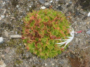
The flora is represented mainly by the plants making up the tundra which covers the permafrost. Such frozen ground would prevent tree roots from reaching deep enough to draw the elements they need for growth. This explains the absence of trees from these regions. The boundary line here between regions with tree cover and those without is the treeline. Ecologists often use it as a defining frontier between the Arctic and the Subarctic regions.
To read more…
Catherine MOCQUARD
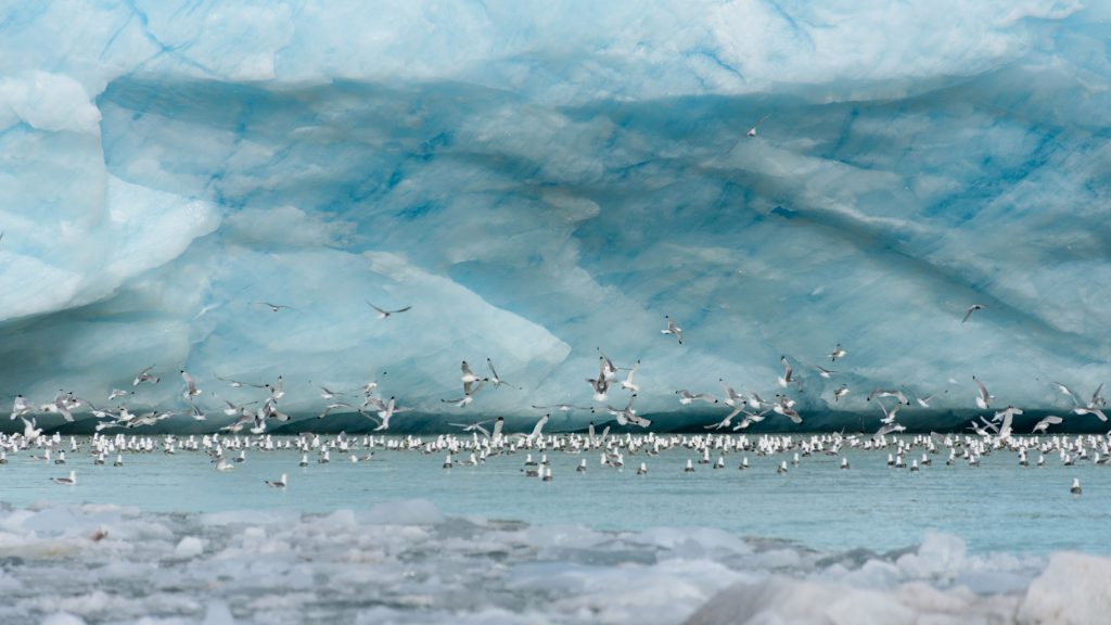
Plankton and krill : The fact that north-south ocean currents meet in the Arctic seas creates waters that are extremely rich in micro-organisms (plankton and krill), the staple food for Invertebrates and Vertebrate. A huge number of these concentrate around the polynyas (area of unfrozen sea within the pack of sea-ice), channels, ice-free coasts and margins of sea-ice.
Animals met in Ny Alesund
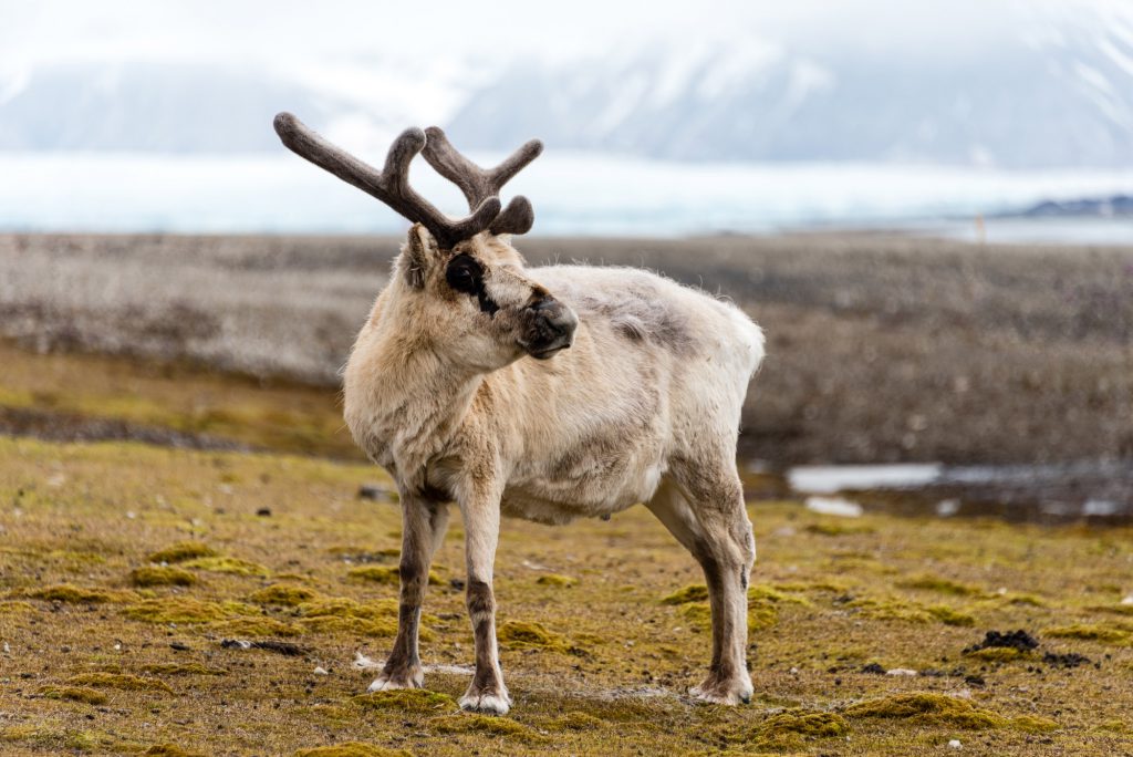
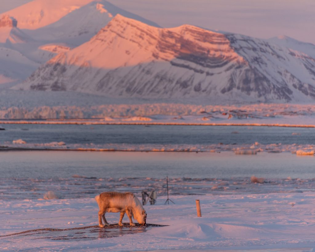
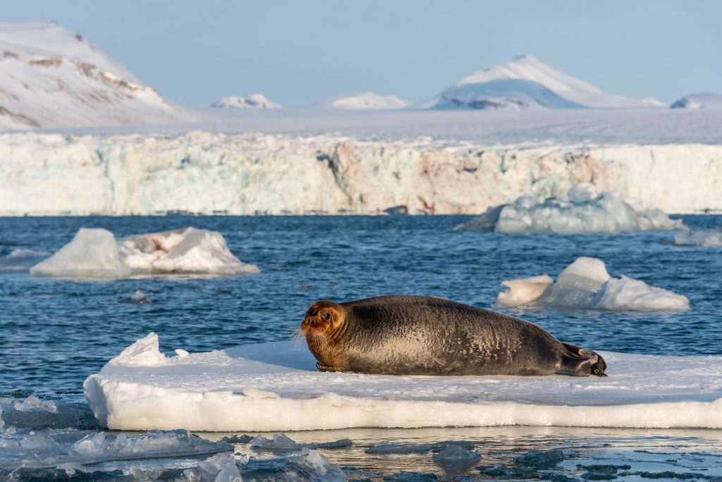
The Mammals, whether terrestrial or marine, are remarkably well adapted to the Arctic world. They have developed characteristics such as hollow hairs, a thick layer of fat or increase in size, which provide them with insulation against cold.
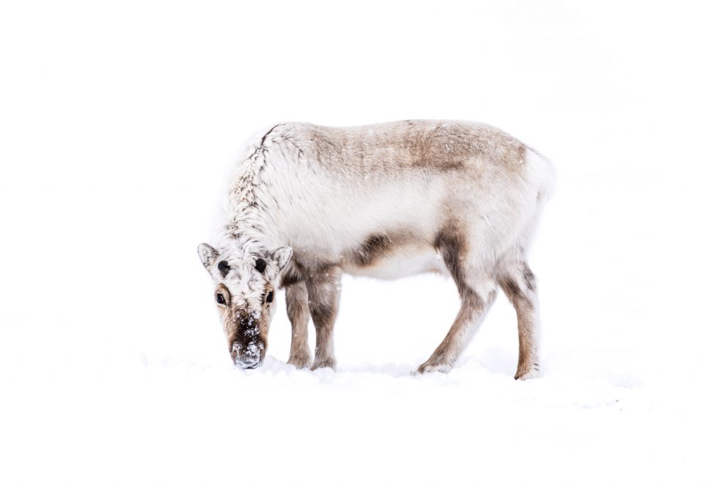
A young reindeer lying in the snow.
Discover the Arctic
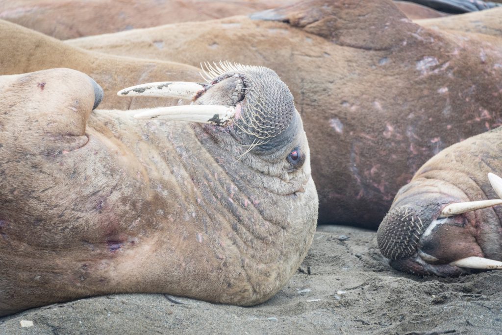
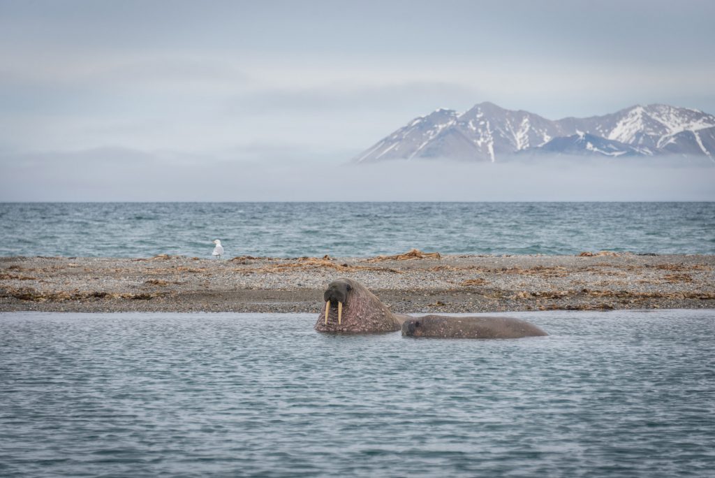
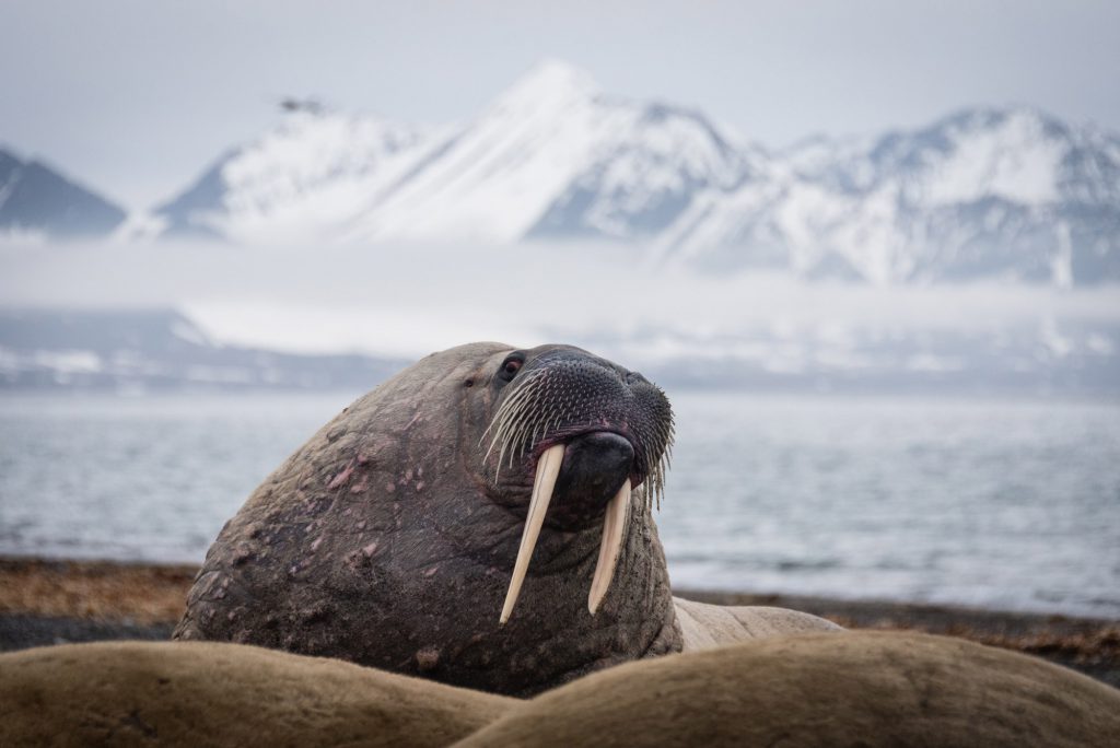
Marine mammals are represented by 6 species of seal, 2 species of sea lion and walrus (Pinnipedia); 11 species of toothed whales (Odontoceti) (Cetacea) such as beluga and narwhal and 8 species of baleen whales (Mysticeti) such as the humpback and the blue whale which feeds on abundant krill it finds in Arctic waters.
A walrus
Discover the Arctic
The tail of a whale
Discover the Arctic
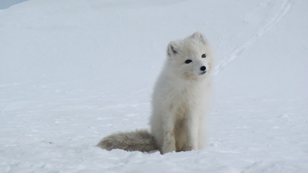
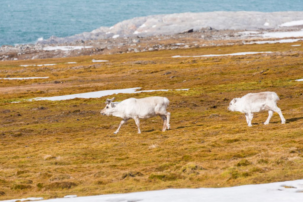
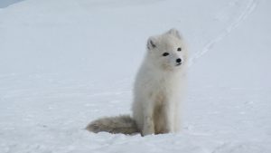
The main land mammals are: polar bear, reindeer (or caribou), musk ox, Arctic fox, wolverine, lemming, and so on.
A polar fox
Discover the Arctic
A polar fox with its summer coat
Discover the Arctic
More than 100 species of bird live in the Arctic regions, but permanent residents are rare (gyre falcon, snowy owl, ptarmigan, common raven, ivory gull, etc.).
There are no penguins in the Arctic! They should not be confused with auks like Alca torda (razorbill) which live in the North Atlantic zones: all of them can fly (since the extinction of Pinguinnis impennis (great auk!) which was the only flightless species).
Discover the Arctic