Quick access
Logistics and implementation of science
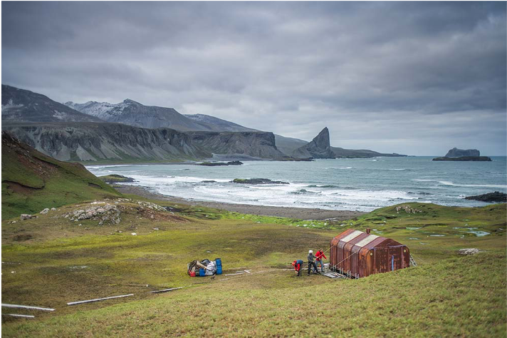
All the islands are equipped with shelters to allow scientists to be deployed over a very large part of the sub-Antarctic islands. Discover the work of the Institute’s teams in the field, a dive into the logistics that must face all the elements.
The shelters
All the islands are equipped with shelters to allow scientists to be deployed over a very large part of the subantarctic islands.
The Polar Institute is therefore in charge of 38 refuges or isolated sites in Kerguelen, 3 in Crozet and 2 on Amsterdam Island.
With each rotation of the Marion Dufresne, the Institute’s logistics teams are deployed on these different sites in order to resupply them, repair them or prepare them for the arrival of scientific projects.
The first means used is the helicopter, an indispensable tool in these environments with very changing climatic conditions and places that are often difficult to access.
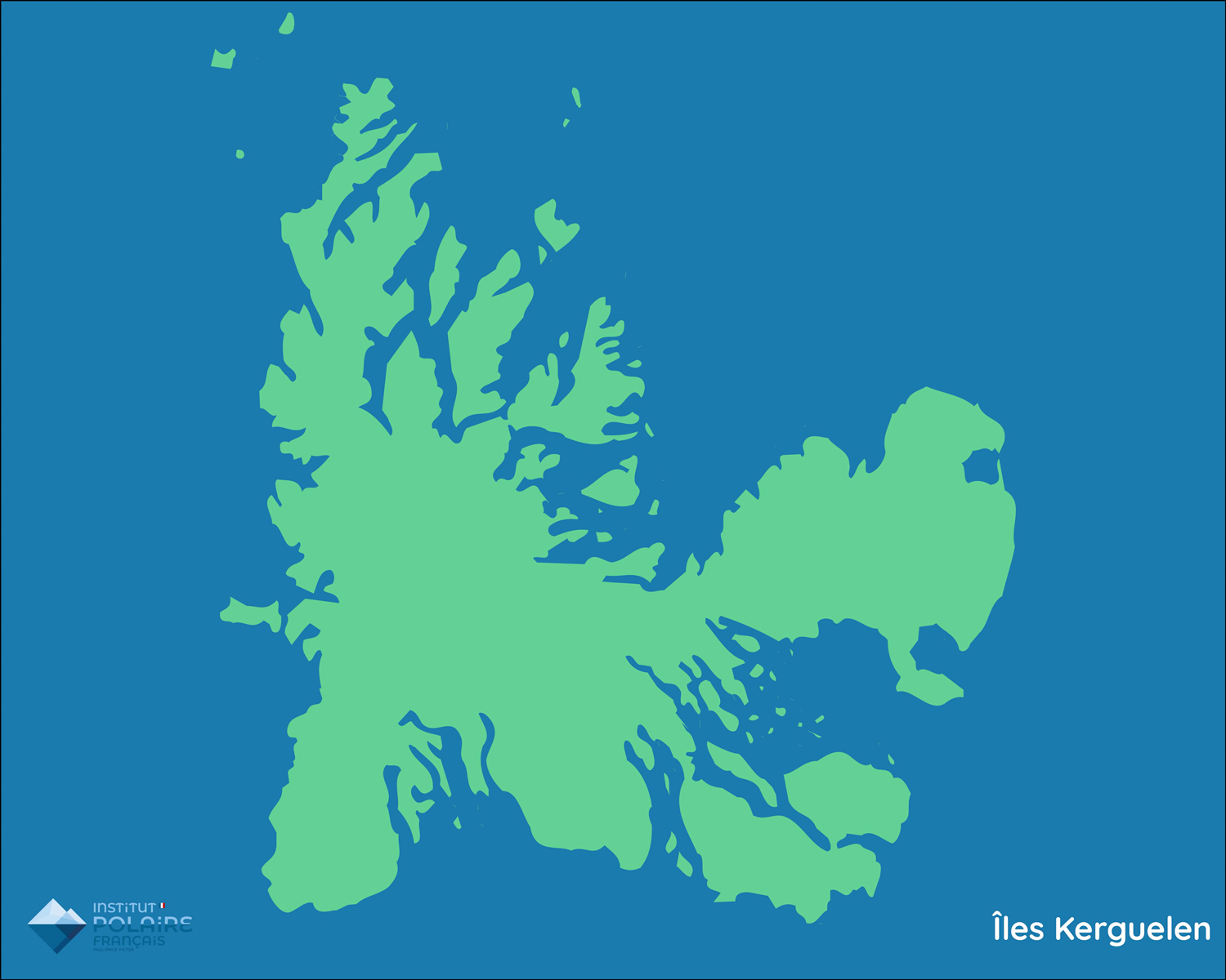
The shelters of Kerguelen
Refuge de la péninsule Courbet
Pointe Suzanne Bas
- Type de refuge : 4 modules ( 1 cuisine, 2 chambres, 1 local science)
- Capacité : 4 + 1 d’appoint
- Eau : Cuve rechargée par hélicoptère, pas de rivière à proximité
- Énergie : Gaz, panneau solaire et groupe électrogène
- VHF
Refuge de la péninsule Courbet
Pointe Suzanne Haut
- Type refuge: 1 module bardé (stockage, principal avec cuisine et lits)
- Capacité : 4
- Eau : Cuve rechargée par HLO, site sans rivière à proximité
- Énergie : Gaz
- VHF
Refuge de la péninsule Courbet
Morne
- Type refuge: 2 modules (1 module de vie et 1 local science) + 1 WC
- Capacité : 4 (+1 d’appoint)
- Eau : Cuve d’eau de pluie
- Énergie : Gaz et groupe électrogène + panneaux solaires
- VHF
- Chantier Institut polaire français 2019-2020
Refuge de la péninsule Courbet
Estacade (TAAF, gestion Institut polaire)
- Type refuge: 1 module vie hexagonal
- Capacité : 4
- Eau : Rivière à proximité
- Énergie : Gaz et groupe électrogène + panneaux solaires
- VHF
Refuge de la péninsule Courbet
Guetteur (Ratmanoff)
- Type refuge : 2 modules (cuisine, 1 atelier, 1 pièce guetteur)
- Énergie : Gaz, panneaux solaires
- VHF
- Démantèlement partiel 2020/21: 2 modules conservés (cuisine et manip)
Refuge de la péninsule Courbet
Manchots (TAAF, ravitaillement Institut polaire)
- Type refuge : 1 module de vie et local science
- Capacité : 4 (+2 d’appoints)
- Eau : rivière à proximité
- Énergie : Gaz et groupe électrogène + panneaux solaires
- VHF
Refuge de la péninsule Courbet
Cap Noir
- Type refuge : 2 modules (chambre, cuisine)
- Capacité : 4
- Eau : Rivière en contre bas de la cabane
- Énergie : Gaz
- VHF
Refuge de la péninsule Courbet
Cap Cotter
- Type refuge : 4 modules (cuisine, chambre, local log, local ornitho + caisse bois)
- Capacité : 4
- Eau : Cuve rechargée par HLO
- Énergie : Gaz et groupe électrogène + panneaux solaires
- VHF
Refuge de la péninsule Courbet
Cataractes
- Type refuge : 2 modules (1 nouveau et 1 ancien)
- Capacité : 4
- Eau : Rivière en contre bas de la cabane
- Énergie : Gaz
- VHF
Refuge de la péninsule Courbet
Rivières du Nord
- Type refuge : 2 modules jumelés et bardés (chambre et espace vie)
- Capacité : 3 + 1 d’appoint
- Eau : rivière à proximité
- Énergie : Gaz et groupe électrogène
- VHF + iridium
Refuge de la péninsule Courbet
Baie Charrier
- Type refuge: 1 module de vie
- Capacité : 3 + 1 d’appoint
- Eau : rivière à proximité
- Énergie : Gaz et groupe électrogèneVHF
- Chantier Institut polaire français 2019-2020
Refuge de la péninsule Courbet
Port Elisabeth
- Type refuge : 1 module igloo
- Capacité : 3
- Eau : lac à proximité
- Énergie : Gaz
- VHF + iridium
Refuge de la péninsule Courbet
Val Studer
- Type refuge : 3 modules (cuisine, chambre, vivres) et 1 toilette ouvert
- Chantier Institut polaire français 2019-2020
- Capacité : 4
- Eau : rivière à proximité
- Énergie : Gaz, panneau solaire et groupe électrogène
- VHF
Refuge des îles du Golfe du Morbihan
Baie de l’Obs (Korrigans)
- Type refuge : 1 module principal, 1 WC, un local stockage
- Capacité : 6
- Eau : rivière à proximité
- Énergie : Gaz
- VHF
Refuge des îles du Golfe du Morbihan
Australia Sud
- Type refuge : 1 module principal, 1 WC, un local stockage
- Capacité : 4
- Eau : Cuve avec récupération d’eau de pluie
- Énergie : Gaz, panneau solaire
- VHF
Refuge des îles du Golfe du Morbihan
Australia Nord
- Type refuge : 1 module principal
- Capacité : 2 couchages + 1 d’appoint
- Eau : prendre avec soi + rivière sèche en été
- Énergie : Gaz
- VHF
Refuge des îles du Golfe du Morbihan
Mayes
- Type refuge: 1 module principal, 1 WC + local stockage
- Capacité : 4
- Eau : Cuve avec récupération d’eau de pluie
- Énergie : Gaz, panneau solaire et groupe électrogène
- VHF
Refuge des îles du Golfe du Morbihan
Guillou
- Type refuge : 1 module principal, 1 WC
- Capacité : 4
- Eau : à amener sur place, source d’eau sulfureuse
- Énergie : Gaz, panneau solaire
- VHF
Refuge des îles du Golfe du Morbihan
Verte
- Type refuge : 3 modules (cuisine, chambre, labo)
- Capacité : 4
- Eau : Cuve avec récupération d’eau de pluie
- Énergie : Gaz et groupe électrogène + panneaux solaires
- VHF
Refuge des îles du Golfe du Morbihan
Cochons
- Type refuge : 1 module principal
- Capacité : 2 couchages + 1 d’appoint
- Eau : source sur la plage, accessible marée basse
- Énergie : Gaz
- VHF
Refuge des îles du Golfe du Morbihan
Cimetière
- Type refuge : 1 en mauvaise état
- Capacité : 3, tente obligatoire
- Eau : rien
- Énergie : rien
- VHF
Refuge des presqu’îles Ronarc’h et Jeanne D’Arc
Port Douzième
- Type refuge : 1 module principal
- Capacité : 4
- Eau : petite rivière à proximité mais faible débit, à amener sur place
- Énergie : Gaz
- VHF
Refuge des presqu’îles Ronarc’h et Jeanne D’Arc
Phonolite
- Type refuge : 1 module principal
- Capacité : 4
- Eau : rivière à proximité
- Énergie : Gaz
- VHF + iridium
Refuge des presqu’îles Ronarc’h et Jeanne D’Arc
Sourcils Noirs
- Type refuge : 1 chalet, 1 caisse matériel science et sécu
- Capacité : 6
- Eau : rivière à proximité
- Énergie : Gaz, panneau solaire et groupe électrogène
- VHF (caisse Popchat en sortie de canyon) + iridium
Refuge des presqu’îles Ronarc’h et Jeanne D’Arc
Port Jeanne d’Arc (TAAF, vivres Institut polaire) – site patrimoine
- Type refuge : 1 bâtiment
- Capacité : 9 + 3
- Eau : Tuyau dans ruisseau
- Énergie : Gaz
- VHF
Refuge du Plateau Central
Armor (TAAF, vivres Institut polaire)
- Type refuge : 1 module principal
- Capacité : 4
- Eau : lac
- Énergie : Gaz
- VHF
Refuge du Plateau Central
Bossière (TAAF, vivres Institut polaire)
- Type refuge : 1 arbec
- Capacité : 4
- Eau : rivière à proximité
- Énergie : Gaz
- VHF + iridium
Refuge du Plateau Central
Gazelle (TAAF, vivres Institut polaire)
- Type refuge : 1 module principal
- Capacité : 3
- Eau : petite rivière à proximité
- Énergie : Gaz
- VHF
Refuge du Plateau Central
Port Couvreux (TAAF, ravitaillement Institut polaire) site Patrimoine : Bergerie Bossière
- Type refuge : 1 module principal
- Capacité : 4
- Eau : rivière à proximité
- Énergie : Gaz et groupe électrogène
- VHF + iridium
Refuge du Plateau Central
Val Travers
- Type refuge : 1 arbec
- Capacité : 4
- Eau : rivière à proximité
- Énergie : Gaz
- VHF + iridium
Refuge du Plateau Central
Lac Bontemps (provisoire)
- Type refuge : 1 module principal, 2 modules chambre/stockage
- Capacité : 4
- Eau : lac à proximité
- Énergie : Gaz
- VHF + iridium
Refuge du Plateau Central
Puy St Théodule (temporaire)
- Type refuge : 1 grotte
- Capacité : 3
- Eau : rivière à proximité
- Énergie : Gaz
- VHF + iridium
Refuge au sud de la Calotte Cook
Mortadelle
- Type refuge : 2 arbecs (vie et stockage)
- Capacité : 6
- Eau : rivière à proximité
- Énergie : Gaz
- VHF + iridium
Refuge au sud de la Calotte Cook
Baie Larose
- Type refuge : 1 arbec
- Capacité : 6
- Eau : rivière à proximité
- Énergie : Gaz
- VHF + iridium
Refuge au sud de la Calotte Cook
La Mouche
- Type refuge : 2 arbecs (vie et stockage), 1 module bois
- Capacité : 4
- Eau : rivière
- Énergie : Gaz
- VHF + iridium
Refuge au sud de la Calotte Cook
Les Deux Frères
- Type refuge : 2 modules (cuisine et stockage)
- Capacité : 0, tentes à ramener
- Eau : rivière à proximité
- Énergie : Gaz
- VHF + iridium
Refuge au nord de la Calotte Cook
Port Cénis
- Type refuge : 1 structure vie, 1 structure couchage
- Capacité : 4 couchages
- Eau : rivière à proximité
- Énergie : Gaz
Refuge au nord de la Calotte Cook
Athéna
- Type refuge : 1 structure vie, 1 structure couchage
- 2 petites caisses bois
- Capacité : 4 couchages
- Eau : lac à proximité
- Énergie : Gaz
Refuge au nord de la Calotte Cook
Port Perrier
- Type refuge : 1 cabane
- Capacité : 4 couchages
- Eau : eau à proximité
- Énergie : sans énergie – à apporter
Ancien site à Kerguelen
Anse du Phoque
Ancien site à Kerguelen
Port Léontine
Ancien site à Kerguelen
Vallée Ring
Ancien site à Kerguelen
Lac Suisse
Ancien site à Kerguelen
Anse du Cartographe
Ancien site à Kerguelen
Glacier
Ancien site à Kerguelen
Pointe Charlotte
Refuge de la péninsule Courbet
Portillon
Refuge des îles du Golfe du Morbihan
St Malo (TAAF)
Refuge des îles du Golfe du Morbihan
Haute (TAAF)
Refuge des îles du Golfe du Morbihan
Laboureur (TAAF)
Refuge des îles du Golfe du Morbihan
Longue (TAAF)
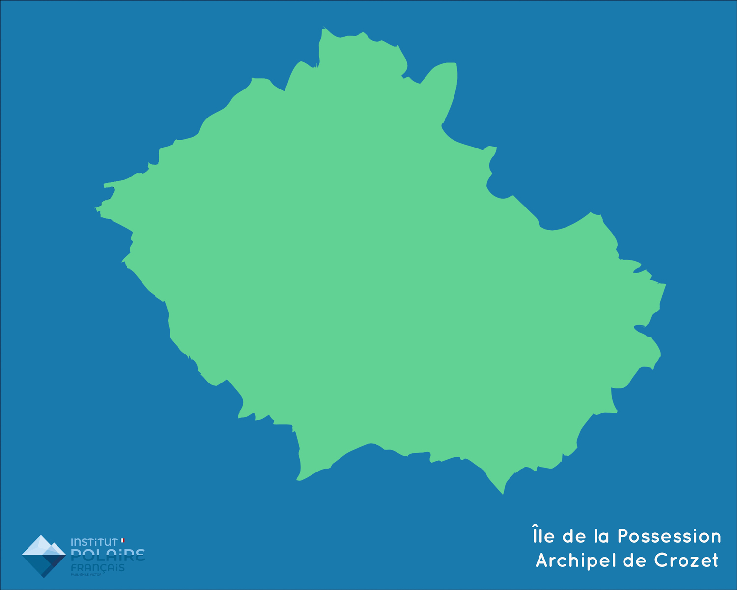
The shelters of Crozet
Baie américaine
- Type refuge : 1 chalet
- Capacité :4 couchages
- 1 arbec métallique magasin
- Eau : rivière à proximité
- Énergie : groupe électrogène, gaz et panneaux solaires
Pointe Basse
- Type refuge : 1 chalet cuisine, 1 chalet couchage + 1 module magasin vivres + 1 arbec matériel science et sécu
- Capacité : 4 couchages
- 1 shelter magasin sur plateforme pilotis métallique magasin
- Eau : rivière à proximité
- Énergie : groupe électrogène, gaz et panneaux solaires
La Pérouse
- Type refuge : 1 module bois
- Toiture bardage métal
- Capacité :4 couchages
- Eau : rivière à proximité
- Énergie : gaz
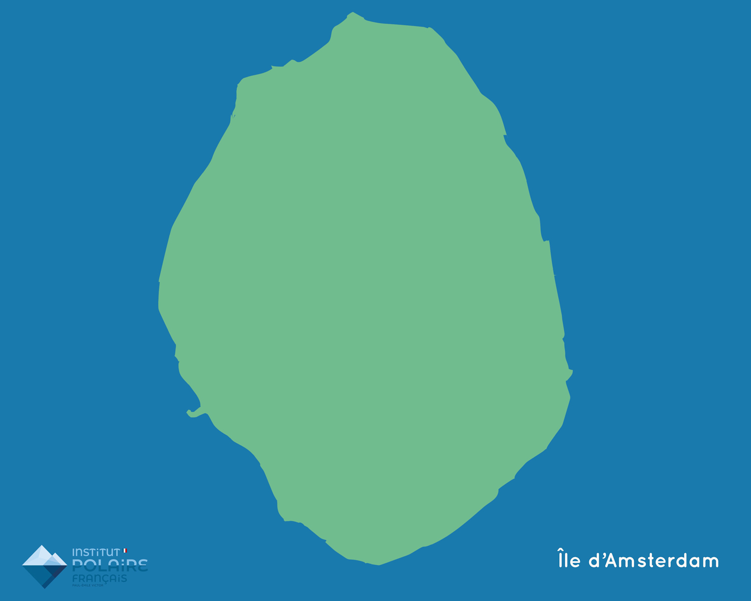
The shelters of Amsterdam
Entrecasteaux
- Type refuge : 2 refuges bois (1 vie + 1 labo)
- Capacité : 4 couchages
- Eau : site sans rivière, eau de pluie
- Énergie : groupe électrogène, gaz et panneaux solaires
- Bon état, entretien régulier
Del Cano
- Type refuge : 1 module bois
- Toiture bardage métal
- Capacité :3 couchages
- Eau : cours d’eau à proximité
On-station laboratories
The Institut de Physique du Globe of Strasbourg is responsible for the permanent magnetic and seismological observatories of Kerguelen, Crozet and Amsterdam Island. Opened during the International Geophysical Year (1957-1958) in Kerguelen and in the 1980s in Crozet and Amsterdam, the magnetic observatory is part of the global network of digital magnetic observatories providing data in near-real time via the INTERMAGNET telecommunication satellites.
The observation program includes the absolute measurement of the elements of the Earth’s magnetic field, the continuous recording of temporal variations, the calculation of activity indices and the determination of the secular variation. The magnetic field measurements are used to describe the field pattern and to update the geomagnetic potential models. The mapping of the main field and its evolution over time (secular variation) are the main sources of information on the dynamics of the core and its interaction with the mantle.
The seismological stations in Kerguelen, opened also during the International Geophysical Year in Crozet in 1986 and on the island of Amsterdam on the Martin-de-Viviès base opened in 1982, are part of the international seismic monitoring network called GEOSCOPE developed by INSU since 1982. This network participates in the localization of earthquakes all over the world, in the determination of the rupture mode of the faults that cause them and also in a three-dimensional X-ray of the interior of the globe. This GEOSCOPE network is integrated in the international monitoring system of the risks related to tsunamis in the Indian Ocean.
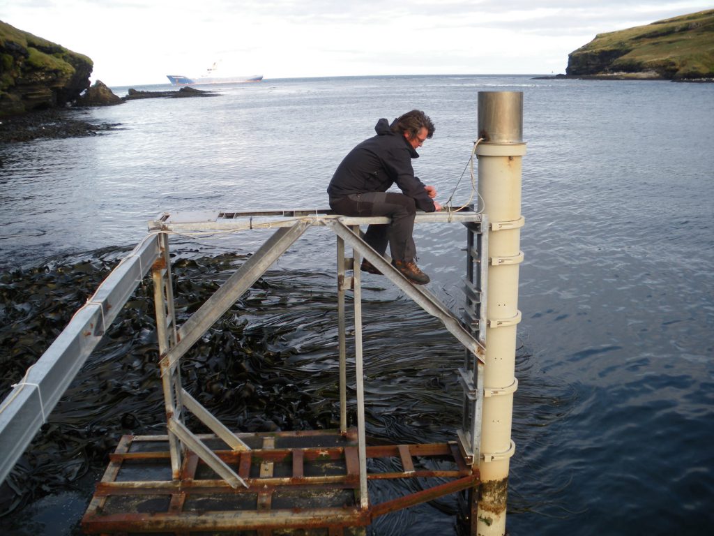
The tide gauges at Kerguelen, Crozet and St Paul of the ROSAME network are developed by the Laboratory of Geophysical and Oceanographic Studies LEGOS. It consists of an automatic tide gauge station that triggers, every half hour and transmits in real time via the Argos system, measurements of atmospheric pressure, air temperature, bottom pressure and water temperature.
The Kerguelen SuperDARN radar is a high frequency radar dedicated to the study of the ionosphere dynamics and the Sun-Earth relations. It emits radio waves, with an adjustable frequency between 8 and 20 MHz, which are refracted in the ionosphere. Part of the energy is backscattered (Bragg scattering) by the irregular structure of the plasma and returns to the radar. The backscattered wave undergoes by Doppler effect a change in frequency proportional to the radial component of the plasma velocity.
In order to measure both the intensity and the direction of the plasma velocity, two radars are located at distant sites covering the same field of view. The radar of Kerguelen, installed during the summer 1999-2000, is paired with a Japanese radar located on the Antarctic base of Syowa. The radar consists of 2 parallel lines of antennas. The main line is 225 m long and has 16 antennas
A total of 15 radars are currently distributed in longitude in the Northern and Southern Hemispheres, surrounding the auroral and polar zones. They form the SuperDARN network (Dual Auroral Radar Network) developed in multinational cooperation: Australia, USA, Canada, France, Great Britain, Italy, Sweden, Finland, Japan, South Africa.
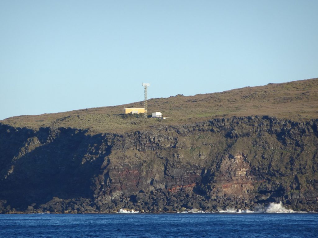
On the island of Amsterdam, the Atmospheric Network for the Measurement of Greenhouse Compounds (RAMCES) allows the long-term monitoring of greenhouse gases. It consists of continuous measurement stations (observatories), surface sampling sites, airborne measurement sites and mobile marine stations.
Amsterdam Island was the first measurement site and remains today the world reference point for greenhouse gas monitoring. The observatory is located in the north of Amsterdam Island at Pointe Bénédicte, on a 70 m cliff about 2 km from the Martin-de-Viviès base. Samples are taken from the top of a 20 m high tower.
Scientific themes deployed by station
The French Polar Institute deploys in the Subantarctic Islands about thirty scientific projects per year on the whole archipelago. The scientific topics cover a wide range of subjects and some are specific to the places.
At Kerguelen, Crozet and Amsterdam
Internal Geophysics
- Seismology: very broad band observation and large-scale dynamics of ground movements (global seismological observatory network)
- Magnetism: Recording of variations in the Earth’s magnetic field, processing of data and dissemination to the world centres through the INTERMAGNET network.
- Sea-level measurement and study of secular variations in sea level: processing and validation of satellite altimetry measurements, tsunami watch.
Logistics and implementation of science
Ecology, ecophysiology, response to environmental variations
Spatio-temporal variations of the environment and ecology of marine birds and mammals, long-term monitoring of marine bird and mammal populations.
Logistics and implementation of science
Ecology, ecophysiology, response to environmental variations
Study of viral and hyperthermophile microbial communities of hydrothermal vents on the island.
Logistics and implementation of science
Ecology, ecophysiology, response to environmental variations
Biodiversity and functioning of terrestrial ecosystems. Impact of climate changes and the introduction of new species.
Logistics and implementation of science
Ecology, ecophysiology, response to environmental variations
Communication of marine birds and mammals: olfaction, optic signals, acoustic signals (role in individual recognition in penguins, choice of partner in petrels and elephant seals)
Logistics and implementation of science
Ecology, ecophysiology, response to environmental variations
Immunological and ecotoxicological assessment of water and Salmonidae in the Kerguelen Islands
Logistics and implementation of science
Ecology, ecophysiology, response to environmental variations
Energy strategy at sea of predators that feed by diving (penguins, cormorants, seals). Remote-sensing ecophysiological study of food-seeking movements, energy quantification, potential bio-indicator of diving predators. Utilization as an investigation platform for physical oceanography.
Logistics and implementation of science
Ecology, ecophysiology, response to environmental variations
Cold-adaptation mechanisms in Antarctic endotherms and ectotherms, integrated approach looking from the whole animal to tissue level and gene expression.
Logistics and implementation of science
Ecology, ecophysiology, response to environmental variations
Physiology, energy capacities and behaviour in the king penguin.
Logistics and implementation of science
Ecology, ecophysiology, response to environmental variations
Study of behavioural and physiological adaptations enabling penguins to withstand environmental constraints (seasonal and inter-annual climate variations) and and ensure reproductive success.
Logistics and implementation of science
At Kerguelen
Spatial Geophysics
- Observation of the nucleon components of cosmic radiation: study of proton acceleration in solar eruptions, understanding of cosmic radiation propagation in the heliosphere
- SuperDARN Programme (Super Dual Auroral Radar Network) using coherent HF radars: continuous observations of convection of the ionospheric plasma in the high latitude regions, auroral zones and polar ice cap.
Logistics and implementation of science
Atmospheric chemistry
Long-term surveillance of the stratosphere (NDSC and WMO networks), climatic impact of PSCs, ozone trends, validation of satellite missions
Logistics and implementation of science
Atmospheric chemistry
Long-term surveillance of the stratosphere (NDSC and WMO networks), climatic impact of PSCs, ozone trends, validation of satellite missions
Logistics and implementation of science
At Crozet and Amsterdam
Atmospheric chemistry
Study of the atmospheric cycle of sulfur. Role of tropospheric aerosols in the Southern Ocean climate system. Quantification of the role of sea salts and impact on atmospheric chemistry
Logistics and implementation of science
Atmospheric chemistry
Long-term monitoring of greenhouse gases CO2, CH4, N2O, SF6
Logistics and implementation of science
Supply : The Marion Dufresne
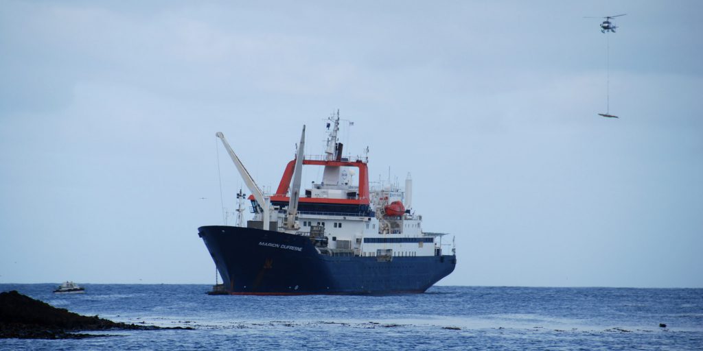
The Marion Dufresne is a multipurpose vessel. Launched in 1995, she has two main functions. The logistics of the French sub-Antarctic islands: Crozet, Kerguelen, Amsterdam/St. Paul, under the responsibility of TAAF.
Oceanographic research: over most of the oceans, it was under the responsibility of the Polar Institute until January 2018 and is now under Ifremer.
Identity card of the Marion Dufresne
- Overall length : 120,50 m
- Width : 20,60 m
- Hollow : 12,80 m
- Draft : 6,95 m
- Displacement : 10.380 t
- Deadweight : 4.900 t
- Freight : 2,500 t
- Propulsion : Diesel-electric
- Propulsion power : 2 x 3,000 kW
- 1 front thruster of 750 kW
- 2 shaft lines
- 2 rudders with ailerons
- Maximum speed: 16 knots
- Passengers: 110
- Crew : 10 officers + 20 sailors + 20 day laborers
- Builder: Ateliers et Chantiers du Havre (delivered on May 12, 1995)
- Owner: Louis Dreyfus Armateur
- Charterers: Ifremer for oceanography and the French Southern and Antarctic Lands (Taaf) for logistics
Thanks to the additional capacities granted by its function as a logistics vessel, the Marion Dufresne is, as a scientific vessel, among the largest in the world fleet. It benefits from an exceptional seaworthiness allowing it to work in all weather conditions. The possibilities of accommodation, cargo transport, handling and autonomy allow the heaviest campaigns at sea. The diesel-electric propulsion gives it the flexibility and discretion necessary for scientific operations. With its numerous equipments, it is operational in all fields of oceanography: marine geosciences, biological oceanography, physics and chemistry of the oceans…
Its specificity is internationally recognized in sedimentary coring and paleoclimatological studies. Thanks to its “giant corer” CALYPSO, it is one of the only vessels to collect sediment cores up to 60 meters long. A research vessel equipped with 650 m² of laboratories, it has a winching system for handling heavy equipment, a Thales multibeam echosounder and a giant calypso corer, unique in the world.
It is also a liner which is used for the transport of the personnel of the bases and the visitors towards the Austral Lands with a capacity for 110 passengers. Her cargo capacity allows her to load containers and heavy parcels with a capacity of 4,600 m³ with the help of two twin cranes of 25 tons and three other service cranes.
This ship is also a tanker carrying fuel for the stations and a helicopter carrier able to receive an Écureuil, Lama or Dauphin type helicopter;
Given the severe navigation areas and environment to which it is subjected, the Marion Dufresne has undergone improvements in terms of onboard safety and reliability compared to the standard of current merchant ships.
Given the severe navigation areas and environment to which it is subjected, the Marion Dufresne has undergone improvements in terms of onboard safety and reliability compared to the standard of current merchant ships.